GPS Scatter Plot v1.13 – GPS Scatter Plot specifically for Android devices
Purchased version of the app for $0.99 on Google Play
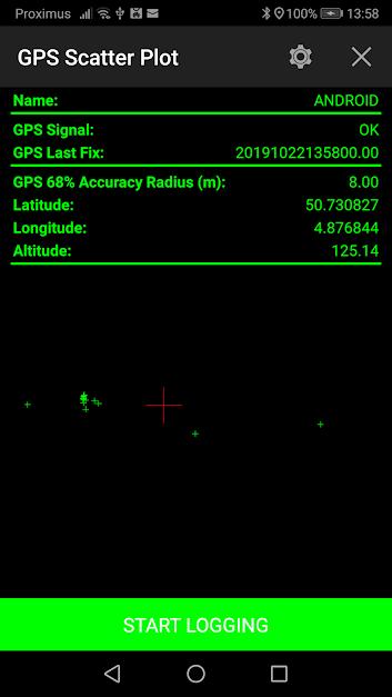
These days, it is rare to find a mobile phone without GPS. GPS is now one of the main features of smartphones and is used for a wide range of tasks. The GPS system was developed by the US military in 1964 for military and intelligence purposes. After a few years, the US government made this system completely free for everyone. Since then, anyone with a GPS receiver can use this service. GPS is made up of 24 satellites that are always orbiting the Earth. There are 4 satellites in each orbit, and their rotation is such that they can overlap. GPS satellites display latitude and longitude for each GPS receiver by performing a series of relatively simple mathematical operations. In common uses such as routing, finding maps, placing geographic information on photos, and other uses, GPS accuracy is high and can fully meet our needs. However, GPS usually only identifies one point at a time. For this reason, when we want to identify multiple points using GPS, we need a special tool. Today we have such a tool at your service. GPS Scatter Plot is an application for recording and maintaining the coordinates of various points using GPS, designed for the Android operating system, developed by Bergin-IT and published on Google Play for $0.99. With this application, you can easily receive and automatically record the coordinates of different points while moving using GPS. You can get the program information in XML, JSON or CSV files and use them for various purposes. The ability to take photos of geographic coordinates is also available. To achieve maximum accuracy, it is better to stay away from tall buildings or tunnels, as they can interfere with GPS signals.
Some features and capabilities of GPS Scatter Plot Android app:
- Registering geographical coordinates of various points while moving
- Outputting program information in XML, JSON or CSV file formats
- Providing output of program information in image format
- Providing average geographical coordinates
- Small program size
GPS Scatter Plot application is an efficient tool for better location registration and display on the map, recently released as a paid app on Google Play. You can now get the purchased version of this app with all its features and capabilities completely free from Farsroid.io. This app is introduced at your request.

-
Version changes 1.13
- Minor changes


Rules for sending comments
ClosePost a comment
Related
0